
Evaluation of Sugarcane Plant Height using UAV Remote Sensing
doi: 10.14456/mijet.2021.15
Keywords:
Sugarcane height, UAV, remote sensing, image processingAbstract
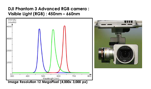
The objective of this research is to evaluate the plant height (PH) of sugarcane during the 3 months pre-harvest using imagery-derived UAV. The study area is located in Muang Phimai District, Nakhon Ratchasima Province, Thailand, by taking aerial imagery by UAV with a 12M pixel camera was acquired by flying at an altitude of 90 meters and analyzed the correlations between PH data 120 data example of field and the data from by the UAV, including reflectance values, and digital elevation model (DEM). The analysis was carried out at ground sampling distance (GSD) 100 cm. Process data was processed using 3 methods of machine learning, such as generalized linear model, decision tree and support vector machine .The result showed correlation between measured PH and estimated PH the support vector machine best accuracy is R2 = 0.82 and RMSE = 0.19, the method presented in this study can be used as a guideline for estimating the above-ground altitude of sugarcane by aerial images from a UAV 3 months prior to harvesting.
References
[2] Ninsawat, S., & Hossain, M. D. (2016). Identifying potential area and financial prospects of rooftop solar photovoltaics (PV). Sustainability, 8(10), 1068.
[3] Nastari, Plinio. 2015. Global trends & perspectives for sugar. http://purl.umn.edu/205045. Accessed 15 January 2016
[4] The esaan record. (2019). Sweetness and Power (5) How Thailand became the sugar cradle of Southeast Asia [online]. Available from: https://theisaanrecord.co/2019/09/11/sweetness-and-power-part-5-th/ [accessed 10 September 2020]
[5] Chu, T., Starek, M. J., Brewer, M. J., Murray, S. C., & Pruter, L. S. (2017). Assessing lodging severity over an experimental maize (Zea mays L.) field using UAS images. Remote Sensing, 9(9), 923.444
[6] Luna, I., & Lobo, A. (2016). Mapping crop planting quality in sugarcane from UAV imagery: A pilot study in Nicaragua. Remote Sensing, 8(6), 500.
[7] Watanabe, K., Guo, W., Arai, K., Takanashi, H., Kajiya-Kanegae, H., Kobayashi, M., ... & Iwata, H. (2017). High-throughput phenotyping of sorghum plant height using an unmanned aerial vehicle and its application to genomic prediction modeling. Frontiers in plant science, 8, 421.
[8] Yu, D., Zha, Y., Shi, L., Jin, X., Hu, S., Yang, Q., ... & Zeng, W. (2020). Improvement of sugarcane yield estimation by assimilating UAV-derived plant height observations. European Journal of Agronomy, 121, 126159.
[9] Feng, A., Zhang, M., Sudduth, K. A., Vories, E. D., & Zhou, J. (2019). Cotton yield estimation from UAV-based plant height. Transactions of the ASABE, 62(2), 393-404.
Photiwut Bunruang was born in 1997 at Buriram province, Thailand. He received his Bachelor degree in department of Civil Engineering from faculty of Engineering, Mahasarakham University, Thailand in 2018.
[10] Furukawa, F., Maruyama, K., Saito, Y. K., & Kaneko, M. (2020). Corn Height Estimation Using UAV for Yield Prediction and Crop Monitoring. In Unmanned Aerial Vehicle: Applications in Agriculture and Environment (pp. 51-69). Springer, Cham.
[11] Bendig, J., Bolten, A., Bennertz, S., Broscheit, J., Eichfuss, S., & Bareth, G. (2014). Estimating biomass of barley using crop surface models (CSMs) derived from UAV-based RGB imaging. Remote sensing, 6(11), 10395-10412.
[12] Zhou, L., Gu, X., Cheng, S., Yang, G., Shu, M., & Sun, Q. (2020). Analysis of plant height changes of lodged maize using UAV-LiDAR data. Agriculture, 10(5), 146.
[13] Demir, N., Sönmez, N. K., Akar, T., & Ünal, S. (2018). Automated measurement of plant height of wheat genotypes using a DSM derived from UAV imagery. In Multidisciplinary Digital Publishing Institute Proceedings (Vol. 2, No. 7, p. 350).
[14] De Souza, C. H. W., Lamparelli, R. A. C., Rocha, J. V., & Magalhães, P. S. G. (2017). Height estimation of sugarcane using an unmanned aerial system (UAS) based on structure from motion (SfM) point clouds. International journal of remote sensing, 38(8-10), 2218-2230.
[15] Han, X., Thomasson, J. A., Bagnall, G. C., Pugh, N. A., Horne, D. W., Rooney, W. L., … Cope, D. A. (2018). Measurement and Calibration of Plant-Height from Fixed-Wing UAV Images. Sensors (Basel, Switzerland), 18(12). https://doi.org/10.3390/s18124092
Downloads
Published
How to Cite
Issue
Section
License
Copyright (c) 2021 Engineering Access

This work is licensed under a Creative Commons Attribution-NonCommercial-NoDerivatives 4.0 International License.