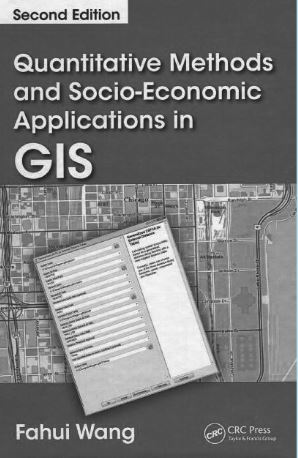
Quantitative Methods and Socio-Economic Applications in GIS
DOI:
https://doi.org/10.56261/built.v12.169214Keywords:
Geographic Information System (GIS), Socio-EconomicAbstract
Integration of quantitative methods on social science research has progressed in studying the complex human or social systems. Geographic Information System (GIS) is the main tool that has capability to integrate and analyze various datasets on spatial aspects. Not only geography researchers who are interested on the interaction of human activity and spatial dimension, but also other social-related fields share the same interests.
Concept and theory before GIS age are quite difficult to explore spatially in the real-world applications for practitioner. However, GIS has capability to integrate quantitative methods with spatial analysis. In this book, the author, Prof. Fahui Wang, has provided both concept and theoretical backgrounds on human geography, city and regional planning of public policy. In addition, the author also demonstrates the example in the real-world applications based on GIS environment largely performed by ArcGIS.
Downloads
References
Luo, W., & Wang, F. (2003). Measures of spatial accessibility to health care in a GIS environment: synthesis and a case study in Chicago region. Environment and Planning B-Planning & Design, 30, 865-884.
LSU Department of Geography & Anthropology. (2018). Curriculum vitae; Fahui Wang. Retrieved October 2, 2018 from https://lsu.edu/ga/people/faculty/fahui-wang/.
Martin, M. E. (2017). A qualitative GIS for social media and big data. (Ph.D. Thesis). Simon Fraser University, Faculty of Environment.
Wang, F. (2015). Quantitative methods and socioeconomic applications in GIS (2nd ed.). Boca Raton, FL: Taylor & Francis.

Downloads
Published
How to Cite
Issue
Section
License

This work is licensed under a Creative Commons Attribution-NonCommercial-NoDerivatives 4.0 International License.


