GIS-Based Flood Susceptibility Mapping Using Statistical Index and Weighting Factor Models 10.32526/ennrj/19/2021003
Article Sidebar
Main Article Content
Abstract
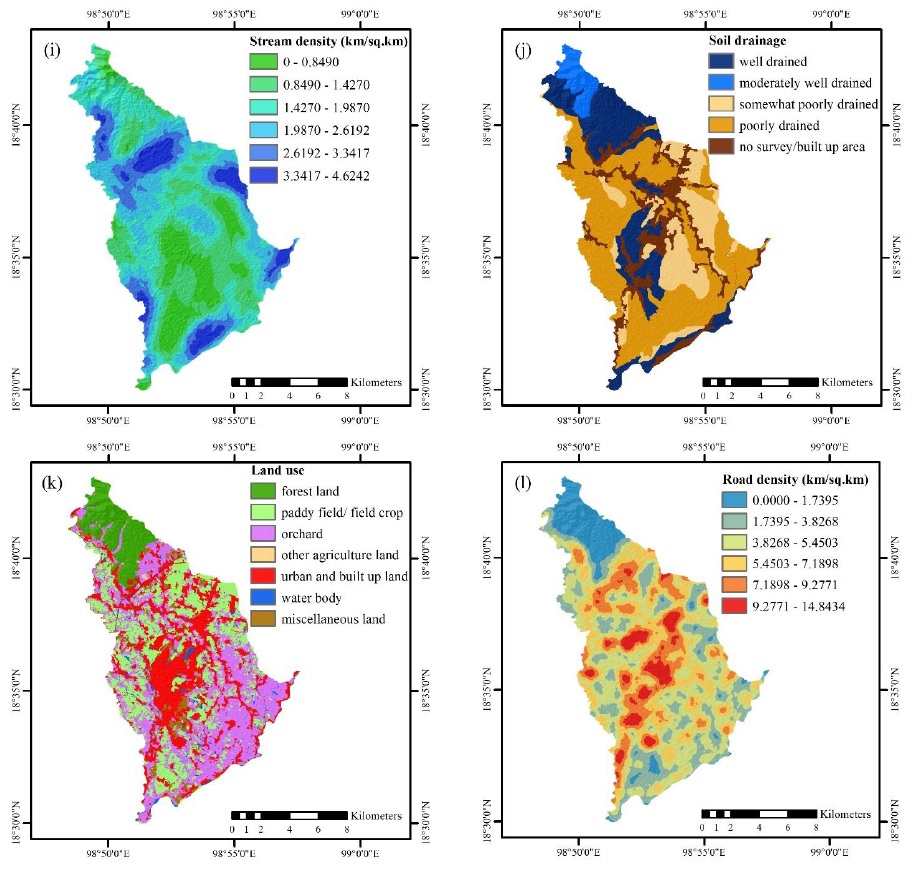
Floods are one of the most devastating natural hazards, causing deaths, economic losses, and destruction of property. Flood susceptibility maps are an essential tool for flood mitigation and preparedness planning. This study mapped flood susceptibility using statistical index (SI) and weighting factor (WF) models in San Pa Tong District, Chiang Mai Province, Thailand. The conditioning factors used to perform flood susceptibility mapping were elevation, slope, aspect, curvature, topographic wetness index, stream power index, rainfall, distance from rivers, stream density, soil drainage, land use, and road density. The flood data were randomly classified as training data for mapping (70% of data) and testing data for model validation (30% of data). The results revealed that the SI and WF models classified 49.49% and 51.74% of the study area, respectively, as very highly susceptible to flooding. In the WF model, the factors with the greatest influence were land use, soil drainage, and elevation. The validation of the models using the area under the curve revealed that the success rates of the SI and WF models were 91.80% and 93.06%, while the prediction rates were 92.05% and 93.52%, respectively. The results from this study can be useful for local authorities in San Pa Tong District for flood preparedness and mitigation.
Article Details
Published articles are under the copyright of the Environment and Natural Resources Journal effective when the article is accepted for publication thus granting Environment and Natural Resources Journal all rights for the work so that both parties may be protected from the consequences of unauthorized use. Partially or totally publication of an article elsewhere is possible only after the consent from the editors.
References
Anucharn T. A comparison the most appropriate method for flood susceptibility map in Khlong Nathawi Subwatershed, Songkhla Province. Journal of King Mongkut's University of Technology North Bangkok 2019;29(4):612-29 (in Thai).
Budha PB, Rai P, Katel P, Khadka A. Landslide hazard mapping in Panchase Mountain of Central Nepal. Environment and Natural Resources Journal 2020;18(4):387-99.
Cabrera JS, Lee HS. Flood risk assessment for Davao Oriental in the Philippines using geographic information system‐based multi-criteria analysis and the maximum entropy model. Journal of Flood Risk Management 2020;13(2):e12607.
Cao C, Xu P, Wang Y, Chen J, Zheng L, Niu C. Flash flood hazard susceptibility mapping using frequency ratio and statistical index methods in coalmine subsidence areas. Sustainability 2016;8(9):948.
Center for Research on the Epidemiology of Disasters (CRED). Natural disaster 2019: Now is the time to not give up [Internet]. 2020 [cited 2020 Nov 10]. Available from: https://emdat.be/natural-disasters-2019-now-time-not-give/.
Hoang DV, Tran HT, Nguyen TT. A GIS-based spatial multi-criteria approach for flash flood risk assessment in the Ngan Sau-Ngan Pho mountainous river basin, North Central of Vietnam. Environment and Natural Resources Journal 2020;18(2):110-23.
Igarashi K, Koichiro K, Tanaka N, Aranyabhaga N. Prediction of the impact of climate change and land use change on flood discharge in the Song Khwae District, Nan Province, Thailand. Journal of Climate Change 2019;5(1):1-8.
Khaing TW, Tantanee S, Pratoomchai W, Mahavik N. Coupling flood hazard with vulnerability map for flood risk assessment: A case study of Nyaung-U Township in Myanmar. Greater Mekong Subregion Academic and Research Network International Journal 2021;15:127-38.
Khosravi K, Pourghasemi HR, Chapi K, Bahri M. Flash flood susceptibility analysis and its mapping using different bivariate models in Iran: A comparison between Shannon’s entropy, statistical index, and weighting factor models. Environmental Monitoring and Assessment 2016;188(12): 656.
Kia MB, Pirasteh S, Pradhan B, Mahmud AR, Sulaiman WNA, Moradi A. An artificial neural network model for flood simulation using GIS: Johor River Basin, Malaysia. Environmental Earth Sciences 2012;67(1):251-64.
Kongmuang C, Tantanee S, Seejata K. Urban flood hazard map using GIS of Muang Sukhothai District, Thailand. Geographia Technica 2020;15(1):143-52.
Oztekin B, Topal T. GIS-based detachment susceptibility analyses of a cut slope in limestone, Ankara-Turkey. Environmental Geology 2005;49(1):124-32.
Paul GC, Saha S, Hembram TK. Application of the GIS-based probabilistic models for mapping the flood susceptibility in Bansloi sub-basin of Ganga-Bhagirathi River and their comparison. Remote Sensing in Earth Systems Sciences 2019;2:120-46.
Pourghasemi HR, Moradi HR, Aghda SMF. Landslide susceptibility mapping by binary logistic regression, analytical hierarchy process, and statistical index models and assessment of their performances. Natural Hazards 2013;69(1):749-79.
Rahmati O, Zeinivand H, Besharat M. Flood hazard zoning in Yasooj region, Iran, using GIS and multi-criteria decision analysis. Geomatics, Natural Hazards and Risk 2016;7(3): 1000-17.
Samanta S, Pal DK, Palsamanta B. Flood susceptibility analysis through remote sensing, GIS and frequency ratio model. Applied Water Science 2018;8(2):66.
Suppawimut W. Spatial analysis of recurrent flood in San Pa Tong District, Chiang Mai Province. Proceedings of the 6th Conference on Research and Creative Innovations; 2020 Sep 2-3; Rajamangala University of Technology Lanna, Chiang Mai: Thailand; 2020 (in Thai).
Tehrany MS, Shabani F, Jebur MN, Hong H, Chen W, Xie X. GIS-based spatial prediction of flood prone areas using standalone frequency ratio, logistic regression, weight of evidence and their ensemble techniques. Geomatics, Natural Hazards and Risk 2017;8(2):1538-61.
Tehrany MS, Kumar L, Jebur MN, Shabani F. Evaluating the application of the statistical index method in flood susceptibility mapping and its comparison with frequency ratio and logistic regression methods. Geomatics, Natural Hazards and Risk 2019;10(1):79-101.
World Bank. Thai Flood 2011, Rapid Assessment for Resilient Recovery and Reconstruction Planning. World Bank; 2012.
van Westen CJ, Rengers N, Terlien MTJ, Soeters R. Prediction of the occurrence of slope instability phenomenal through GIS-based hazard zonation. Geologische Rundschau 1997; 86:404-14.
Yalcin A. GIS-based landslide susceptibility mapping using analytical hierarchy process and bivariate statistics in Ardesen (Turkey): Comparisons of results and confirmations. Catena 2008;72(1):1-12.
Yesilnacar EK. The Application of Computational Intelligence to Landslide Susceptibility Mapping in Turkey [dissertation]. Melbourne, Australia: University of Melbourne; 2005.
